Left: ODIQ can tap
into Google Street
View to help identify
possible causes of
congestion
We’ve been getting increasing
volume of probe data, not just from
smart phones, but also from connected
vehicles and from logistics companies
Alex Gordy, director of product management for traffic
services, Here Technologies
congestion caused by their works –
because it enables them to plan to
deploy site traffic at the least
impactful times.
Here and now
While Google data is reliant
on location services being
enabled on Google-owned
apps (including YouTube)
running on smart devices,
rival firms cast their net a
little wider when it comes to
gathering floating-car data.
“We’ve been leading the market in
tapping into other sensors,” says Alex
Gordy, director of product
management for traffic services for
Here Technologies. “We’ve been
getting increasing volume of probe
data not just from smart phones but
also from connected vehicles and
from logistics companies. We put it
all together and use it to compute
high accuracy traffic information –
speeds, congestion levels, road
closures, construction etc. We collect
information from well over 100
different suppliers worldwide so it’s
a wide range of devices.
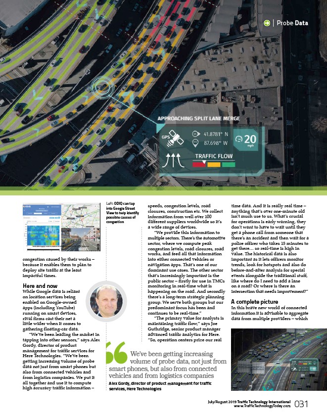
“We provide this information to
multiple sectors. There’s the automotive
sector, where we compute peak
congestion levels, road closures, road
works, and feed all that information
into either connected vehicles or
navigation apps. That’s one of our
dominant use cases. The other sector
that’s increasingly important is the
public sector – firstly for use in TMCs
monitoring in real-time what is
happening on the road. And secondly
there’s a long-term strategic planning
group. We serve both groups but our
predominant focus has been and
continues to be real-time.”
“The primary value for analysts is
maintaining traffic flow,” says Joe
Guthridge, senior product manager
advanced traffic analytics for Here.
“So, operation centers prize our real
| Probe Data
time data. And it is really real time –
anything that’s over one-minute old
isn’t much use to us. What’s crucial
for operations is early warning, they
don’t want to have to wait until they
get a phone call from someone that
there’s an accident and then wait for a
police officer who takes 15 minutes to
get there… so real-time is high in
value. The historical data is also
important as it lets officers monitor
trends, look for hotspots and also do
before-and-after analysis for special
events alongside the traditional stuff,
like where do I need to add a lane
on a road? Or where is there an
intersection that needs improvement?”
A complete picture
In this brave new world of connected
information it is advisable to aggregate
data from multiple providers – which
www.TrafficTechnologyToday.com 031
July/August 2019 Traffic Technology International
/www.TrafficTechnologyToday.com