Connected Mapping |
COMTRANS Smart City Winner |
the public and private
sector,” says Neil Ackroyd,
acting CEO for OS. “The
initial trials are already
delivering a deeper and
richer level of data capture
which we are confident will
bring added value to our
customers and become an
important dataset for emerging
markets, and a building block
for Britain’s infrastructure for
many years.”
Real-world trials
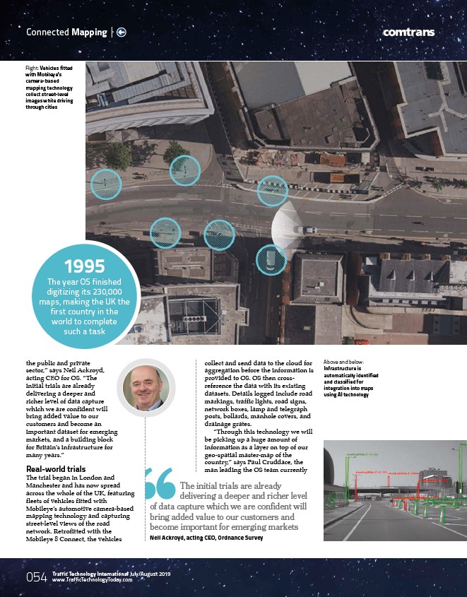
The trial began in London and
Manchester and has now spread
across the whole of the UK, featuring
fleets of vehicles fitted with
Mobileye’s automotive camera-based
mapping technology and capturing
street-level views of the road
network. Retrofitted with the
Mobileye 8 Connect, the vehicles
??? 054 Traffic Technology International August/July/August September 2019
2016
www.TrafficTechnologyToday.c com
om collect and send data to the cloud for
aggregation before the information is
provided to OS. OS then crossreference
the data with its existing
datasets. Details logged include road
markings, traffic lights, road signs,
network boxes, lamp and telegraph
posts, bollards, manhole covers, and
drainage grates.
“Through this technology we will
be picking up a huge amount of
information as a layer on top of our
geo-spatial master-map of the
country,” says Paul Cruddace, the
man leading the OS team currently
The initial trials are already
delivering a deeper and richer level
of data capture which we are confident will
bring added value to our customers and
become important for emerging markets
Neil Ackroyd, acting CEO, Ordnance Survey
1995
The year OS finished
digitizing its 230,000
maps, making the UK the
first country in the
world to complete
such a task
Above and below:
Infrastructure is
automatically identified
and classified for
integration into maps
using AI technology
Right: Vehicles fitted
with Mobileye's
camera-based
mapping technology
collect street-level
images while driving
through cities
/www.TrafficTechnologyToday.c